Deutsch

BS Contact Geo

BS Contact Geo enables the visualization of geographic information in third-party hardware and software products. BS Contact Geo is based on BS Contact and its capacity. The software is expanded and is focussing on the special requirements of the GIS community using ISO standard compliant formats like CityGML and Geo-nodes [pdf 628kb].
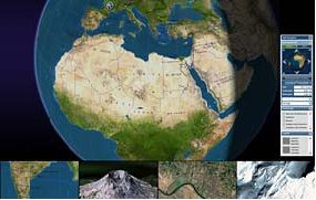
Bitmanagement – Interactive Web3D Graphics – visualization for VRML, X3D, Collada, kmz, CityGML

Bitmanagement offers in the area of GIS or Geo visualisation a special realtime and online capable 3D Viewer. This earth viewer supports special geo formats like X3D geo nodes, CityGML or Google kmz.

Together with software for data preparation – here reduction, tiling, creation of LODs and encryption – 3D landscapes based on satellite and orthofotos or point clouds can be visualized in realtime and online.

The advantages of interactivity coming from VRML and X3D can be used in GIS applications as well. The data preparation is major important for 3D visualization in the geo viewer as plugin for web3d in order to achieve realtime and internet applications.

Visit our BS Contact GEO Demo.

Geo visualization is based on digital data captured from various sources (land surveys, CAD, satellite imagery, airborne laser scanning etc.). Geo data is increasingly used in the fields of geo-science, surveying, cartography and landscaping. The possibility of deploying such intensive datasets via the Internet facilitates the development of useable, accessible 3D applications in areas such as environmental monitoring and mobile information services.


GIS Visualization

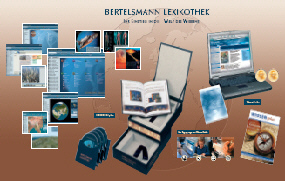
Integrated consumer product

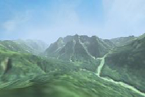
Flight animation with preemptive caching
(streaming of geo-referenced terrain tiles)

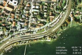
GIS for your business model
(Geo Demo Data by GeoContent)
Demonstrations-Video (80 MB)

Architecture visualization - walkthrough

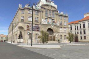
Photorealistic city models

Interactive city model
with photo mapping (JPEG 2000)

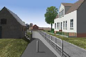
Urban development planning on the web
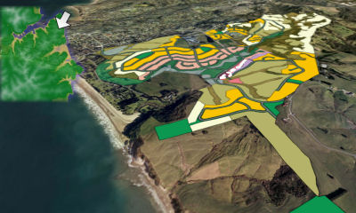
With BS Contact Geo we address the needs of customers providing specific solutions in areas such as:
  • GIS
  • Digitization of Geo data
  • 3D laser scanning
  • Collection and evaluation of satellite data
  • Application development based on geo data like globe projects, web based intranet GIS systems or social communities


The integration of the Geo viewer technology within customer applications is described in the BS SDK package through an API. Please contact us for further information, presentation of the software or specific Geo data processing inquiry.

Please download the test version of BS Contact Geo and the user's guide or check the systems requirements in the Download Center.